Before buoyage was invented, which standardizes maritime navigation worldwide, sailing was a dangerous and intuitive profession. Thanks to buoyage signals, these maritime indicators have made navigation much safer.
What Are Maritime Buoyage Marks?
These signals are essential, especially as ships approach ports, shallow areas, channels, rivers, etc. These indicators, which are usually on the water's surface, help guide us safely. These are known as maritime buoyage signals.
They cover any type of situation or hazard, such as capes, sandbanks, river entrances, ports, etc. Let's list the main functions of buoyage:
- Mark navigable channels, estuaries, and rivers, as well as coastal areas.
- Indicate water depth.
- Mark hazardous or restricted navigation zones.
- Signal the entrance to anchorage areas or ports.
- Make visible special navigation zones or military areas.
- Indicate courses.

Maritime Signal Buoys
This section aims to simply and intuitively guide you on how to distinguish each buoyage signal:
At a glance, they are relatively easy to recognize:
- Large hazard areas: These are cardinal signals used in black and yellow buoyage with top marks shaped like black cones. The position of the color bands and the cones changes according to the cardinal point where the signal is located. This allows the captain to know the approach direction of their vessel and avoid obstacles. The light is always white.
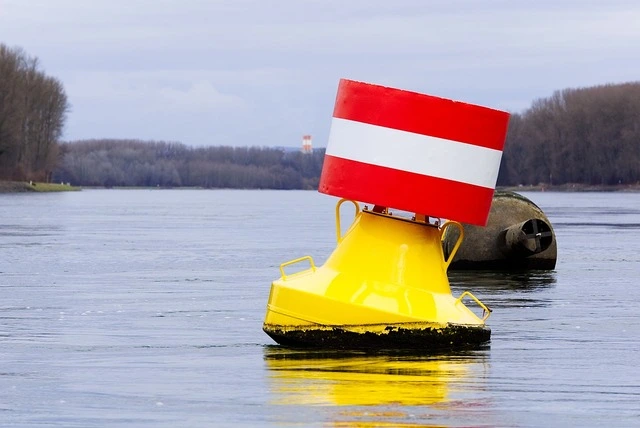
- Approach or identification signals for anchoring points feature wide, prominent red and white longitudinal lines with a red ball on top. If required by law, they also have a white light.
- Isolated danger signals: These are indicated with a buoy that is black and red, with a top mark of two spheres aligned vertically.
- New dangers: They have yellow and blue stripes with a yellow cross as a top mark.
- Yellow buoys and beacons are used to mark special areas. If they have a light, it is yellow. They are easily identifiable by their cross-shaped mark and color.
Buoy Naming and Regulation
Depending on the country or region, signals may have different appearances and meanings. To standardize navigation aids worldwide, the IALA (International Association of Lighthouse Authorities) or AISM (International Maritime Signal Association) was officially established in July 1957 to regulate and eliminate signal variations across countries, creating a system that enhances maritime safety.
Until the 1970s, dozens of signaling systems existed worldwide, confusing vessels navigating between different countries or continents. Eventually, the IALA maritime buoyage system was adopted globally.
This led to two navigational zones:
- Zone A: Applied in Europe, Africa, Oceania, and Asia (excluding Japan, Korea, and the Philippines).
- Zone B: Used in the Americas, Japan, Korea, and the Philippines.
The primary difference is in the use of lateral signal colors, which are reversed. In Zone A, green buoys should be kept to starboard, while in Zone B, they should be kept to port—a straightforward and effective method.

Lateral Navigation Signals
These lateral buoyage signals are more complex, so we’ll provide a detailed explanation.
Lateral signals are intended to mark navigation channels, whether rivers or sea entrances. They are strategically placed to show the limits of channels, helping vessels avoid running aground or colliding with others.
These signals follow a regulated color code and can be lighted or unlighted. The interpretation of Zone A and Zone B also varies here, with port marks red and starboard marks green.
Buoys can have various shapes, but the top mark must be cone-shaped.
The Purpose and Uses of Nautical Buoys
Nautical buoys play essential roles in navigation and safety. Here are their various functions:
- Course marking: Buoys mark navigation channels, indicating the correct direction for safe passage.
- Hazard signals: Various buoys warn of hazards like rocks, shipwrecks, sandbanks, shallow areas, reefs, military zones, restricted areas, etc., turning dangerous areas into navigable ones.
- Zone identification: Buoys mark specific areas, such as fishing zones, restricted military zones, various danger zones, polluted areas, protected areas, restricted navigation zones, etc.
- Positioning: Buoys provide visual reference points for cargo and recreational vessels, aiding orientation, especially in low-visibility conditions.
- Alert signals: Some buoyage signals in complex areas have lights or sound signals to warn of dangers or specific challenges, like approaching a port or nearby hazards.
- Position determination: Buoys, used with nautical charts, help mariners determine their position, especially in coastal zones.
In general, buoys are essential tools for safe and effective navigation, providing captains with vital information.

Types of Maritime Buoys
According to international maritime signaling standards, different types of buoys and beacons are classified into six groups. Although many share shapes or similarities, each signal or buoy has a specific code to avoid misinterpretation and ensure safety for vessels and lives.
- Isolated danger signals: These mark a pinpoint hazard directly below the buoy, indicating the area to navigate around it.
- New danger signals: Recently identified risks may not appear on charts. These emergency buoys are used for 24–72 hours to mark sandbanks, rocks, or shipwrecks before an official radio broadcast.
- Cardinal signals: These include four buoy groups, each at a cardinal point, demarcating areas with extensive hazards or risks.
- Special signals: These mark areas of special interest that may not pose a navigation hazard (e.g., oceanographic and meteorological data collection areas, underwater pipelines or cables, military maneuver zones, protected fishing areas, shipwreck sites, etc.).
- Safe water signals: These buoys are mainly in natural channels, estuaries, and anchorage areas to indicate the deepest, safest waters for navigation.
- Lateral signals: These mark the sides of a channel, port entrances, etc.
Just as road signs guide us on land, maritime buoyage signals guide us at sea. Like roadwork signs or speed limits, these maritime signals regulate traffic, which continues to grow annually due to increasing commercial and recreational maritime activities.


